Bedanta Goswami, and colleagues from G&G and Ifremer (France) have published a new research article in Journal of Geophysical Research: Solid Earth entitled “A joint electromagnetic and seismic study of an active pockmark within the hydrate stability field at the Vestnesa Ridge, West Svalbard margin”.
Gas hydrates are ice-like crystals with a molecule of gas occupying the cavity created by the lattice of water molecules. They are stable under high pressure and low temperature conditions which are found beneath the cold deep-water sediments of our study site Vestnesa Ridge, in the Arctic Ocean. Recent scientific expeditions have observed numerous active seafloor seeps expulsing methane bubbles into the water column, along the crest of the ridge, which have intrigued researchers.
What do we already know?
The methane emissions tend to occur around seafloor pockmarks, which are features often associated with active fluid flow systems. Acoustic chimneys are also observed beneath most of these pockmarks on seismic reflection data that suggest gas migrating to the seafloor, through the gas hydrate stability zone.
New insight with joint electromagnetic and seismic analysis
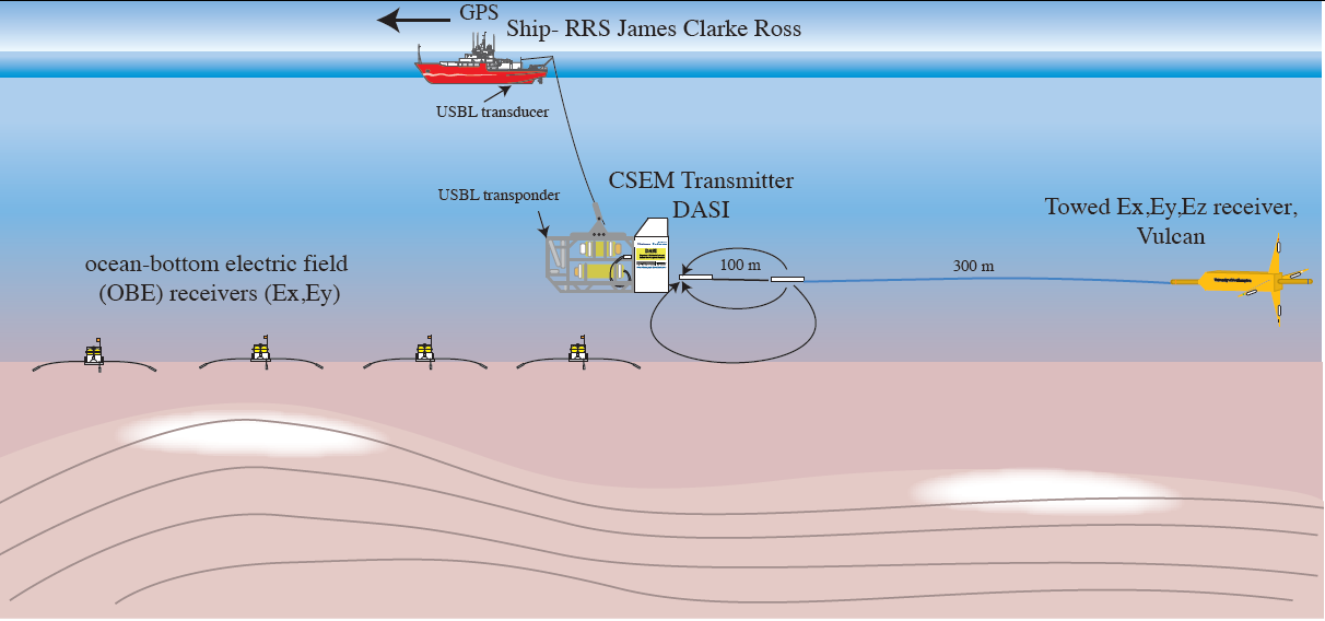
This paper shows the advantage of integrating controlled source electromagnetic (CSEM) data with other remote geophysical methods for an improved understanding of the fluid escape chimney features in the deep-water Vestnesa Ridge. Resistivity models obtained from CSEM are highly sensitive to pore fluid saturation, which provides better constraints to estimate hydrate and gas saturations when combined with seismic velocity. The joint resistivity, velocity and seismic reflection analysis provides new insight into the presence of both hydrate and free gas within the chimney feature within the gas hydrate stability zone. For more details, see: http://onlinelibrary.wiley.com/doi/10.1002/2015JB012344/abstract