
Currently browsing tag

Portus Project; Geophysics; Roman Archaeology

Electrical Resistivity Tomography on the Isola Sacra

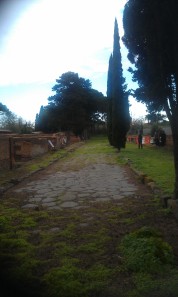
Further to my last post, the week before last was spent with a team from the British School at Rome carrying out a single Electrical Resistivity Tomography (ERT) profile across part of the Isola Sacra, designed to complement the magnetometer survey of the area, and recent coring undertaken by Ferreol Salomon. The Necropolis di Porto, showing the Via Flavia, between Portus and Ostia Antica. Continue reading →

Portus Field School Week Two: canals, boats and local residents

The second week of the field school started in reflective mood, with a wander down the length of the Roman canal or Fossa Traiana that still forms the principal link between the modern town of Fiumicino, the coast and the Tiber. In spite of the balmy weather and the tranquil evening, the sea was in restless mood, with the waves breakingon the breakwater, and waves channelling up the canal, one after the other, pitching the fishing boats against the edge of the jetty. Continue reading →