In order to monitor the early effects of tidal inundation on the morphology and sedimentology of an artificial creek system, fieldwork was undertaken between the 5th and the 11th of September at the Steart peninsula. Participants to this fieldwork were new G&G postgraduate student Clementine Chirol, responsible for the PhD project on the morphological evolution of managed realignment schemes conducted at the National Oceanography Center; Tyra Standen, PhD candidate at the Centre for Maritime Archaeology, University of Southampton; and Heiko Loehr, Msc Engineering in Coastal Environment graduate.
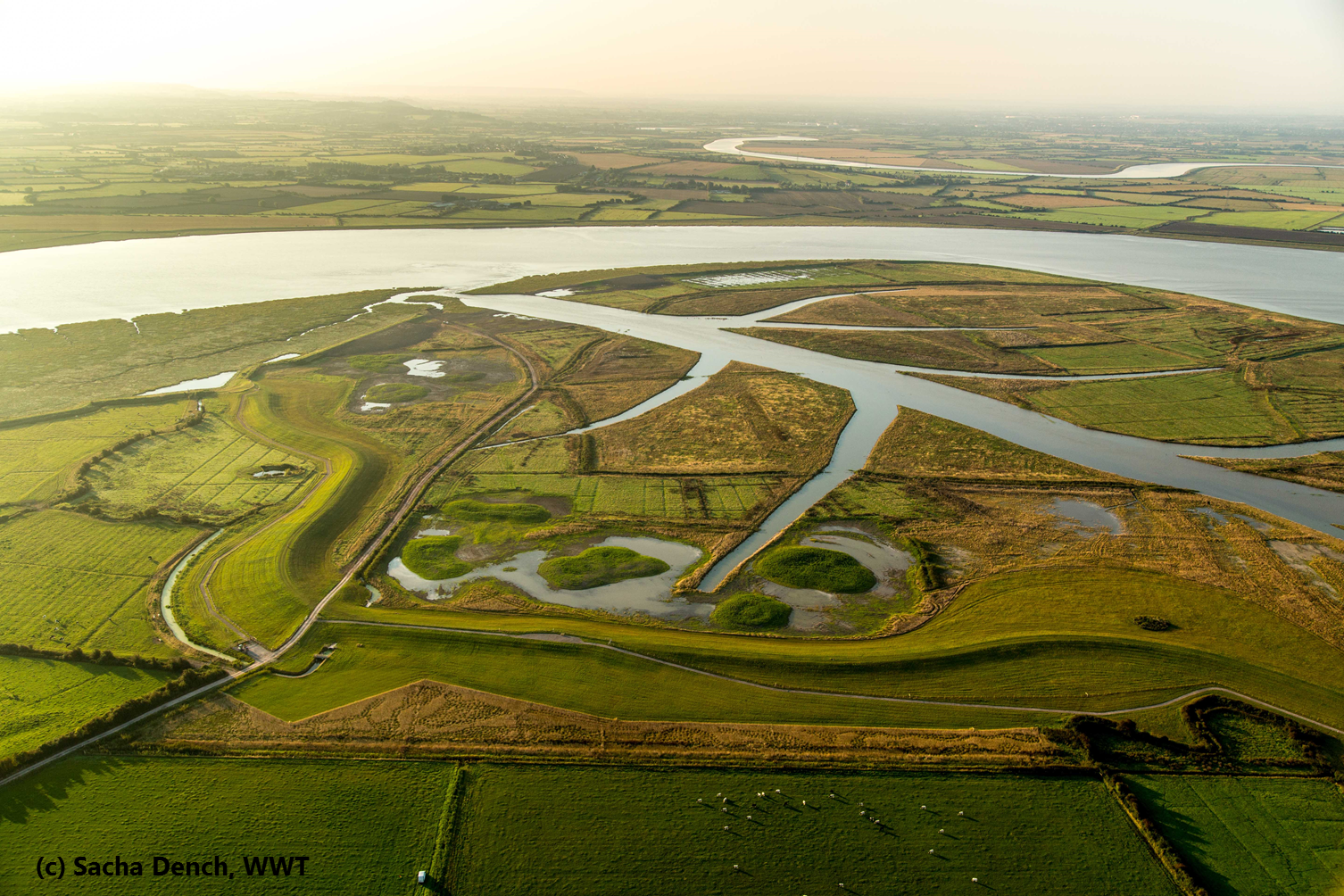
The Steart peninsula is the largest managed realignment scheme undertaken in the UK, with 400 hectares of new habitats created to compensate for the losses related to coastal squeeze. To that end, flood defences are moved further inland and previously reclaimed farmlands are opened up to tidal inundation. As saltmarshes naturally attenuate wave and tide energy, the new flood defences will be more durable.
The project was designed and modelled by CH2M Hill on behalf of the Environment Agency; the construction phase was carried out by Team Van Oord. The completed site is now managed by the Wildfowl and Wetlands Trust (Tim McGrath).
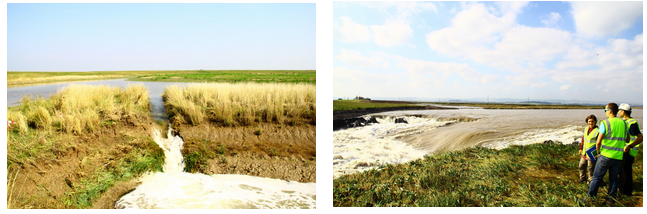
The flood defences were breached on 1st September 2014 by Team Van Oord. With the increasing spring tide, the site’s channel was first flooded to full bank on the 7th. The highest spring tide was reached on 10th September (Hinkley Point: 7.05 m).
The aim of the PhD is to monitor the morphological evolution of the entry channel and creek network over several years as the site transitions to a more natural shape. Results from this project should help improve the design of future realignment schemes.
This early fieldwork campaign undertaken around the time of the first inundation focused on the creek system: in fact, due to the rapid erosion and turbulent flow, no deployment could be made in the breach area. We had two objectives: firstly, to perform a baseline survey of one of the creeks’ morphology and sedimentology that would help quantify all future changes. Secondly, to observe the early effects of the tide on the morphology and sediment strength at the Steart managed realignment site.
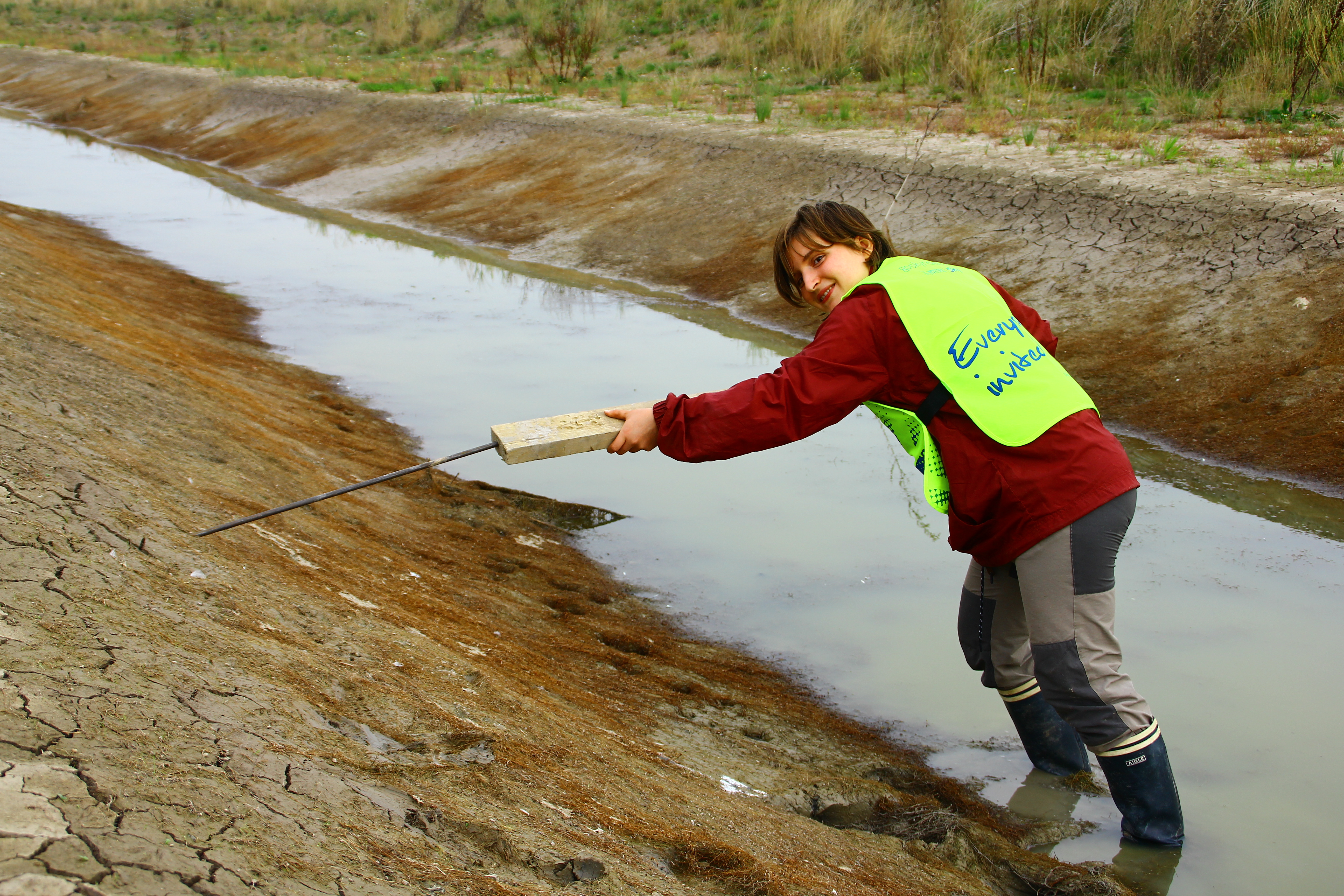
T o this end a GPS survey of one of the creeks’ outline was realised, as well as several cross-sections along the length of the creek. Stakes in the ground were used to evaluate the accumulation or erosion of sediment at the banks. Sediment samples and syringe cores were taken to assess the bulk density and the organic matter concentration. The cohesive strength of the sediment was measured every day along the creek with a CSM (Cohesive Strength Meter) during the time of the fieldwork. The successive inundations of the site were monitored by two Gopro cameras covering the studied creek and the entry channel.
This fieldwork was a great opportunity to witness the realisation of an ambitious realignment project. It will also provide a valuable baseline to monitor the evolution of this area.