-
Recent Posts
- CLLEAR seminar Friday 6th October: Prof Tania Ionin 26/09/2017
- TNS Workshop 6th July 19/06/2017
- CLLEAR Thurs 25th May @ 4pm: Prof Jennifer Smith and Dr Sophie Holmes-Elliot 22/05/2017
- CLLEAR Seminar Wednesday 17th May: Prof Alessandro Benati 11/05/2017
- CLLEAR Seminar Friday 5th May: Dr Neal Snape 27/04/2017
Archives
Mapping knowledge in culture and science, past, present and back to the future
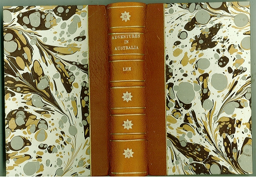
Mapping – cartographical, cultural, linguistic, scientific – has been central to development of European networks of knowledge and exchanges with other cultures, but saw a period of particularly important development in the early nineteenth century. Bitter military rivalries such as the Napoleonic Wars are only one side of the story. The other is international collaboration in new scientific knowledge gathering from expeditions to other parts of the globe, with specimens and drawings then sent back to the Jardin des Plantes in Paris and London’s British Museum. Behind this deceptive popular adventure story written by Mrs Lee (‘formerly Mrs T. Edward Bowdich’) in 1851 lies a scientifically accurate encounter with indigenous flora and fauna deriving (among others) from Baudin’s explorations of Australia. As Mrs Bowdich, Sarah had studied these in Paris where, unusually for a woman, she was mentored at the Jardin des Plantes by Alexander von Humboldt and Georges Cuvier.
A text written in English may therefore translate larger maps of international science, and who could map it, because Sarah Bowdich was no armchair translator. She had undertaken voyages of scientific discovery, and unlike her explorer husband, lived to tell her tales in science. This is one snapshot of my transdisciplinary research in Modern Languages that crosses culture and science with the multimedia of their dissemination. A second is
The Ordnance Survey Data Enrichment Project
Researchers from the Ordnance Survey and the University of Southampton have joined together to work on an interdisciplinary research project that focuses on data enrichment in a digital age.
Dr Jenny Harding (Ordnance Survey) and Professor Mary Orr (Modern Languages) lead the research team with Glen Hart (Ordnance Survey), Ashley Wright (Ordnance Survey), Dr Sophie Stalla-Bourdillon (Law) and Laura German (Web Science) as co-investigators.
This research focuses on how data at Ordnance Survey can be further enriched for business, research and leisure users through data mining of existing data and linking to other external datasets. It explores the potential for data enrichment at the Ordnance Survey and how this could be achieved (where necessary) by modification to its existing provenance metadata, legal, technological and ethical frameworks.
This one-year project is funded by Ordnance Survey and sponsored by the University of Southampton.
An indication of the range of geographic data types involved in the research can be viewed via links from
http://www.ordnancesurvey.co.uk/business-and-government/products/mastermap-products.html