Written by Alex Phillips
It’s now been almost a month since fellow MRes student Tessa and I returned from Zimbabwe; where we split our time between the Dambari Wildlife Trust and the beautiful Matobo National Park that is part of the Matobo Hills World Heritage Site. Though it was odd to be apart and back in the Northern Hemisphere’s “summer” we had no time to lose. With little over a month to write our thesis we got straight into the nitty gritty of statistical analysis.
My research project investigates the drivers of distribution of large herbivores (grazers and browsers) within the park. Environmental variables such as habitat type and distance to water have been shown to significantly affect the distribution of large mammals within an environment. Dietary differences between browsers and grazers are likely to affect their choice of habitat as well as their water dependency, driving their vicinity to water sources. Previous research in the park has been focused largely on grazers, especially rare species such as white rhino Ceratotherium simum, so it has been interesting to take a wider look at some of the larger antelopes such as greater kudu Tragelaphus strepsiceros.
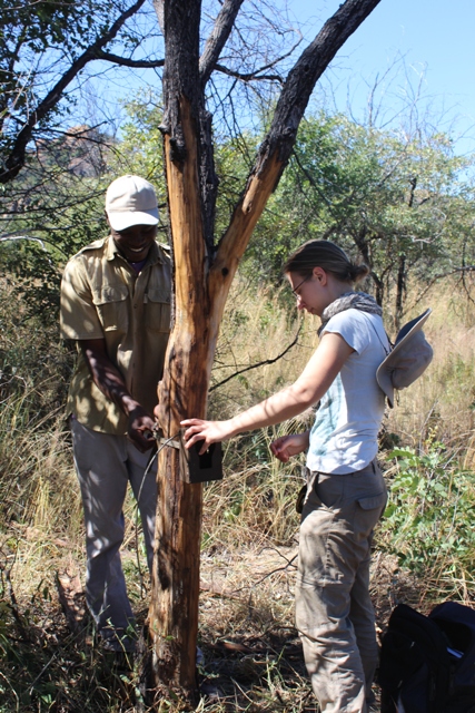
Tafadzwa Tichagwa
(Dambari Field Research Officer) and Alex setting up camera traps
My data was collected via 60 transects, proportionately allocated between different habitat types on the basis of the area covered. We used our newly acquired GIS skills to determine random start points for 100m long transects. We would make a first visit to the site to set up the transect, take measurements of elevation and clear it of any pre-existing dung or spoor. We would also set the camera trap in areas showing evidence of animal use i.e. dung/spoor, trails or feeding patches. We would then revisit the transect a week later and carry out dung and spoor surveys as well as collecting the camera traps. Any sources of surface water encountered were also noted down on our GPS devices. Back in the office the transects and water sources were mapped out in ArcGIS and useful information such as the distance to water were calculated. So now it’s down to the statistical analysis and fingers crossed my models will give some interesting results!
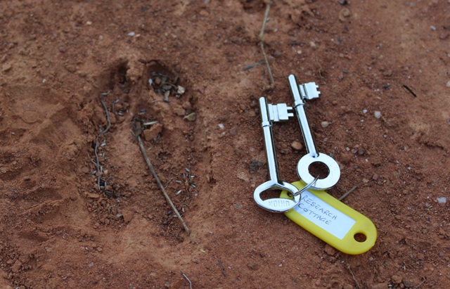
Example of greater kudu (Tragelaphus strepsiceros) spoor
I truly enjoyed my time in Zimbabwe: I learnt a good deal about tracking, camera trapping, GIS, and African mammal behaviour in general. What made it most special for me though was living and working in a breathtakingly beautiful National Park, the fantastic wildlife encounters with some of the most endangered animals on the planet, and meeting some amazingly passionate and dedicated people.
Posted By : Danielle Free