Topographical Survey
This chapter, and the chapter on geophysical survey, present a summary of prospecting methods used on archaeological sites to survey visible archaeological and topographic features, and the extent and nature of sub-surface archaeological structures, remains and features. All of these techniques have been used to a greater or lesser degree to survey the site of Portus or the hinterland of the port between 1998 and 2012. The work has always placed an emphasis on the integration of different survey results, including topographic survey, geophysics and collection of remotely sensed imagery, to facilitate a deeper understanding of the site and its hinterland.
Topographical Survey
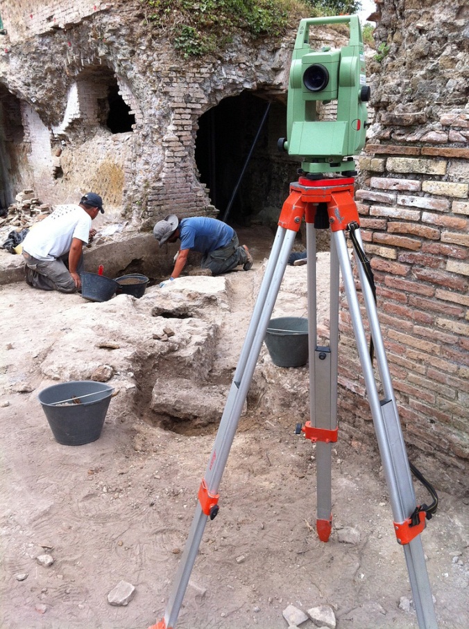
The Portus Project uses a wide range of methods to explore the archaeology of the site, both above and below ground. In order to fully understand the complex stratigraphy and standing walls, the project draws upon techniques such as topographical and building survey (using Total Stations and Global Positioning Systems), photogrammetry, laser scanning and Reflectance Transformation Imaging (for a fuller discussion of these techniques, see Keay et al 2011). The combination of these technologies allows researchers to examine, record and present the surface layers of the site and its artifacts in extraordinary detail.
The following document outlines the various recording methods that you will be involved with on site, and how you should proceed.
Background
Topographical survey provides the framework for all the work undertaken on site, ensuring the data is accurately and precisely located within the same coordinate system. Over the course of the preceding geophysical survey work (Keay et al 2005), a local coordinate control network was established for the work at Portus, which was subsequently globally located using a GPS from 5 fixed control points around the site. The survey is also tied into features shown on digital maps of the survey area. These features act as further control stations and enable cross-checking using triangulation (Bettess 1992:86), and are further strengthened by the surveying of a closed loop traverse (Bannister, Raymond and Baker 1998). These standard surveying methods allow control to be exercised over minor inaccuracies in readings.
The Portus Project digital data is managed and supported through the Archaeological Recording Kit (Ark). A fundamental aspect of this is the underlying GIS, meaning therefore that all data generated on site should be spatially located. This is achieved through a range of techniques.
Techniques
The following techniques are used on site by the Portus Project for excavation, standing building and finds:
Total Stations
The Portus Project uses a range of Leica Total Stations, including a TC307 and a Flexline TS02 5” Power (R400).
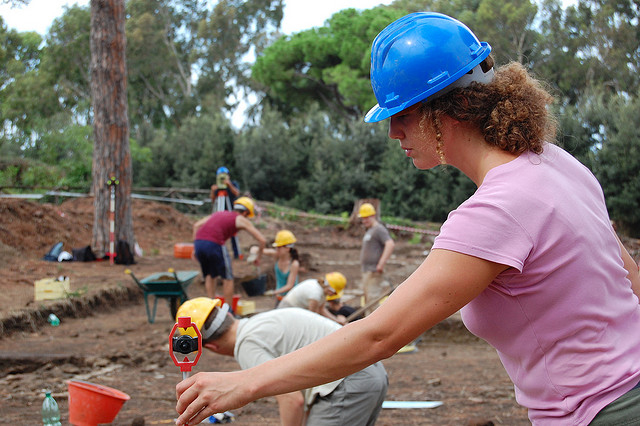
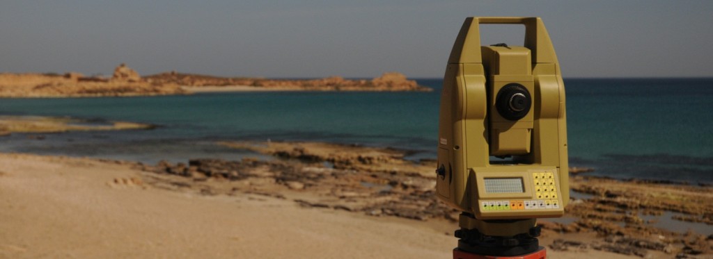
The Total Station is an electronic theodolite integrated with an electronic distance meter (EDM) to read distances from the instrument to a particular point. Coordinates of an unknown point relative to a known coordinate can be determined using the total station as long as a direct line of sight can be established between the two points. Angles and distances are measured from the total station to points under survey, and the coordinates (easting, northing and elevation) of surveyed points relative to the total station position are calculated using trigonometry and triangulation. To determine an absolute location a Total Station requires line of sight observations and must be set up over a known point or with line of sight to 2 or more points with known location.
Laser Scanning
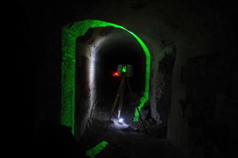
The laser scanning at Portus has over the years developed from small object scanning to large architectural scans. The scanners employed at Portus have been a Vivid 910 triangulation scanner (small object), a Leica Scanstation 2 and a Leica Scanstation C10 both of which are time of flight scanners. Each type of scanner offers a different resolution of data recorded; this year at Portus will again be updating the scanner used by employing the use of Faro Focus 3D phase scanner. The technology works by sending a laser beam out towards an object; time of flight calculates the time taken for the laser beam to rebound back to the scanner whereas the phase measures the subtle changes in the length of the laser beam. Using a laser scanner allows for an exact replica of the object scanned, which can be used as a tool for investigation as line data can be extracted, animations can be created, and changes over time can be observed. Laser scanning again relies on line of sight, but using multiple scan position we are able to create a complete model which can be manipulated into any position, allowing users access to views that have previously been unavailable.
The Faro Focus 3d which will be used on sight this year has an accuracy of ±2mm, a range of 0.6m to 120m and the measurement rate of 976,000 points per second. It has an integrated camera to capture RGB values per point, which allows colour to be added to the model and can be used in both light and dark conditions. The laser scan models already completed have over a billion points and are linked together in collaboration with the total station data and the photogrammetry data to create an exact 3D replica of the site and excavated areas.
Photogrammetry
Digital photogrammetry uses multiple photographs of the same object or surface to derive surface details of the archaeological material. The photogrammetric technique has been available to archaeologists for generations, but recent innovations in digital photography, computer hardware, and computer vision have improved the speed and quality of the results. At a large scale, this method allows our team to produce comprehensive images of walls and floors belonging to particularly complex multi-phase buildings by means of a small number of photographs: hand-drawn plans of these structures would take far longer. In particular, we have concentrated on high-resolution photogrammetry that not only generates visual representations, but also metrically-accurate survey records. The results of this approach can be comparable to – or even better than – data gathered using a non-contact digitizer, such as a laser scanner.
Reflectance Transformation Imaging
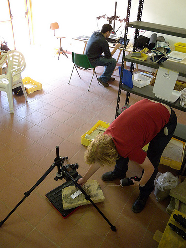
Reflectance Transformation Imaging (RTI) is a mechanism for manipulating multiple images under different lighting conditions to capture very subtle surface information. At a basic level, it operates under the principle that a surface illuminated at a grazing angle has different luminance to a surface lit from above. By taking many photographs in controlled conditions, the RTI technique captures a very precise record of changing surface shape.
At Portus, the team has employed this methodology in a variety of circumstances, from the recording of portions of buildings and excavated contexts, through to microscopic examination of finds. Such records have proven a useful means to assess necessary conservation measures and degradation over time, but more importantly they have allowed archaeologists and other specialists to identify very degraded details on objects such as brick stamps and coins. Not only is RTI quick and simple to use, but it can be very low cost and, as such, is available to a broad range of researchers.
Workflow on site
When recording with the total station and taking points with the measuring poles it is important to note the following:
- Staff height – Over the course of the excavation, two measuring poles will be used, a mini- prism (max. height 1.30m) and a larger survey pole (min. height 1.6m – max 5.0m).
- The context number of the feature.
This information should be relayed to the surveyor in order that the information can be correctly coded and recorded in the Total Station.
Excavation
The following should be recorded on site with the Total Station during the excavation:
- Levels – A series of topographic levels should be recorded before the excavation of a context. The context should be clean, and the levels taken immediately after it has been photographed. Levels should record the highest and lowest points of the context, with some intermediate levels.
- Context limits – The limits of each context (ie cut, layer, pit etc) should be recorded prior to its excavation. This will later be integrated into the trench and site plan.
- Special finds – The location of all special finds (ie brick stamps, coins, etc) should be recorded with the Total Station. This should be done either immediately at the moment of discovery or marked with a nail to be recorded as soon as possible.
- Environmental samples – Your supervisor may wish to take an environmental soil sample during the excavation of a context. The position of this sample should be recorded with the Total Station.
- Skeletal remains – During the excavation of a skeleton (many have been excavated at Portus) it is important a constant series of levels are taken. This includes the burial cut (when visible), burial fill and on the skeleton itself (head, shoulders, pelvis, knees, ankles).
Planning
The majority of the planning on the Portus Project is undertaken using a Total Station. This includes the following:
- Traditional planning – If you hand draw a plan of a feature, such as a pit, wall or skeleton, it is important that your drawing has a number of points within it recorded with the Total Station and clearly marked on the plan (the plan should also have a drawing no.), in order that the drawing can later be geo-referenced in the project GIS.
- Section drawings – Section are either drawn by hand or using photogrammetry (see above). If you draw a section by hand, the section line (usually the points at either end) should be recorded with the Total Station in order to allow the 3D-positioing of the drawing in ARK.
- Planning with the Total Station – Where large areas need to be planned (and photogrammetry and laser scanning are deemed inappropriate) the Total Station is used to provide a base underlay plan. A series of points are marked across the area and subsequently surveyed using the Total Station. These points are then printed (usually at a scale of 1:20) to provide an underlay for a hand drawing. This method, developed by the Portus Portus, is both accurate and quick, and provides a blend of both technology and traditional archaeological drawing techniques.

