Geophysical Survey
A number of different geophysical survey techniques can be applied by archaeologists to record the remains of sub-surface archaeological structures, depending on the different terrain and nature of a site or landscape, and the requirements of the survey. For instance magnetometer survey is generally chosen as a relatively time-saving and efficient survey technique (Gaffney et al. 1991: 6), suitable for detecting kilns, hearths, ovens and ditches, but also walls, especially when ceramic material has been used in construction. In areas of modern disturbance, however, the technique is limited by distribution of modern ferrous material. Resistance survey, while more time consuming is generally successful at locating walls, ditches, paved areas and banks, and the application of resistance tomography allows such features to be recorded at various depths.
Geophysical Methods at Portus
Fieldwork at Portus between 1998 and 2012 has seen the adoption of a number of different prospecting techniques, applied in response to a variety of research questions relating to the archaeological deposits. These have included extensive landscape survey to locate remains over large areas, and more intensive, high resolution survey to investigate specific areas of the site. The following section gives a summary of the techniques that have been applied.
Resistivity Survey
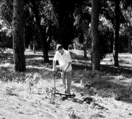
Resistivity survey is based on the ability of sub-surface materials to conduct an electrical current passed through them. All materials will allow the passing of an electrical current through them to a greater or lesser extent. There are extreme cases of conductive and non-conductive material (Scollar et al. 1990: 307), but differences in the structural and chemical make-up of soils mean that there are varying degrees of resistance to an electrical current (Clark 1996: 27).
The technique is based on the passing of an electrical current from probes into the earth to measure variations in resistance over a survey area. Resistance is measured in ohms (W), whereas resistivity, the resistance in a given volume of earth, is measured in ohm-metres (W m).
Four probes are generally utilised for electrical profiling (Gaffney et al. 1991: 2), two current and two potential probes. Survey can be undertaken using a number of different probe arrays; twin probe, Wenner, Double-Dipole, Schlumberger and Square arrays.
The most popular method of resistance survey used at Portus utilises a Geoscan Research RM15 Resistance Meter in twin electrode probe formation. This array represents the most popular configuration used in British archaeology (Clark 1996; Gaffney et al. 1991: 2), usually undertaken with a 0.5m separation between mobile probes. Details of survey methodology are dealt with elsewhere (Geoscan Research 1996).
A number of factors may affect interpretation of twin probe survey results, including the nature and depth of structures, soil type, terrain and localised climatic conditions. Response to non-archaeological features may lead to misinterpretation of results, or the masking of archaeological anomalies. A twin probe array of 0.5m will rarely recognise features below a depth of 0.75m (Gaffney et al. 1991). More substantial features may register up to a depth of 1m. With twin probe arrays of between 0.25m and 2m, procedures are similar to those for the 0.5m twin probe array.
Although changes in the moisture content of the soil, as well as variations in temperature, can affect the form of anomalies present in resistivity survey results, in general, higher resistance features are interpreted as structures which have a limited moisture content, for example walls, mounds, voids, rubble filled pits, and paved or cobbled areas. Lower resistance anomalies usually represent buried ditches, foundation trenches, pits and gullies. In addition to the normal twin electrode method of survey, a Geoscan Research MPX15 multiplexer can be utilised with the Resistance Meter, allowing multiple profiles of resistivity to be recorded simultaneously, or resistance tomography to be carried out up to a depth of 1.5m.
Magnetic Survey
Magnetic prospection of soils is based on the measurement of differences in magnitudes of the earth’s magnetic field at points over a specific area. Principally the iron content of a soil provides the basis for its magnetic properties. Presence of magnetite, maghaemite and haematite iron oxides all affect the magnetic properties of soils. Although variations in the earth’s magnetic field which are associated with archaeological features are weak, especially considering the overall strength of the magnetic field of around 48,000 nanoTesla (nT), they can be detected using specific instruments (Gaffney et al. 1991).
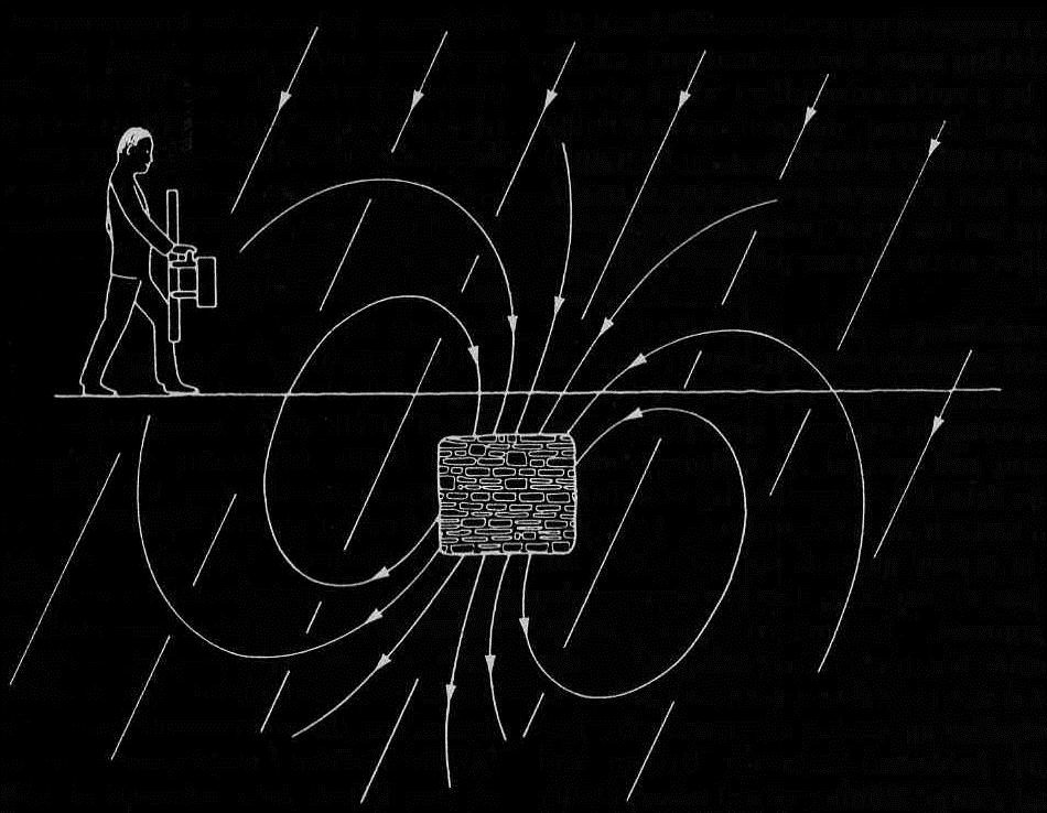
Three basic types of magnetometer are available to the archaeologist; proton magnetometers, fluxgate gradiometers, and alkali vapour magnetometers (also known as caesium magnetometers, or optically pumped magnetometers). Fluxgate instruments are based around a highly permeable nickel iron alloy core (Scollar et al. 1990: 456), which is magnetised by the earth’s magnetic field, together with an alternating field applied via a primary winding. Due to the fluxgate’s directional method of functioning, a single fluxgate cannot be utilised on its own, as it cannot be held at a constant angle to the earth’s magnetic field. Gradiometers therefore have two fluxgates positioned vertically to one another on a rigid staff. This reduces the effects of instrument orientation on readings.
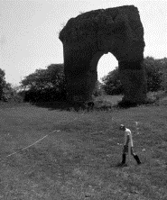
Archaeological features such as brick walls, hearths, kilns and disturbed building material will be represented in the results, as well as more ephemeral changes in soil, allowing location of foundation trenches, pits and ditches. Results are however extremely dependent on the geology of the particular area, and whether the archaeological remains are derived from the same materials. For fluxgate gradiometer survey Geoscan Research single sensor instruments were used at Portus until the adoption of more advanced Bartington Grad601-2 dual sensor equipment. This is a twin array probe, so carries two fluxgate gradiometers which work simultaneously to increase the speed of a survey. Survey is carried out at 0.1nT resolution, with readings taken every 0.5m by 0.25m. In flat and open territory around 1 hectare per day can be surveyed by each instrument.
Ground Penetrating Radar Survey (GPR)
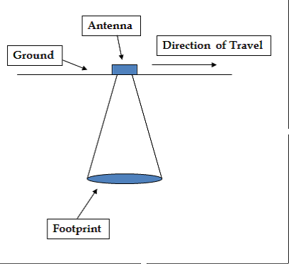
Ground Penetrating Radar (GPR) survey is based on the use of an electromagnetic radar wave propagated through the soil to search for changes in soil composition and the presence of structures, measuring the time in nanoseconds (ns) taken for the radar wave to be sent and the reflected wave to return. The propagation of the signal is dependent on the Relative Dielectric Permittivity of the buried material.
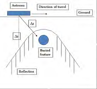
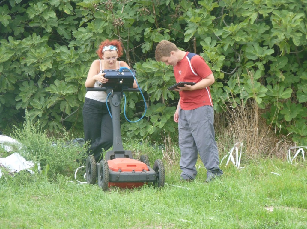
This technique has been applied successfully on a range of archaeological sites, in particular over substantial urban archaeological remains. GPR survey at Portus has utilised a Sensors and Software radar system, configured for use with a Smartcart frame and console. This utilises a 500 MHz antenna, which allows propagation of radar waves down to a depth of approximately 3-4m depending on the nature of the sub-surface materials. More recently a GSSI 400MHz antenna has been used giving a similar prospecting depth to the Noggin. In addition GSSI 100MHz antennae have been applied in the hinterland, giving 10m propagation through the ground.
Electrical Resistivity Tomography (ERT)
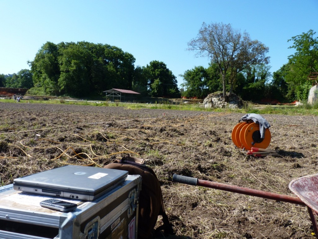
Electrical Resistivity Tomography (ERT) survey works on the basic principles of resistivity survey described above, but allows the surveyor to take measurements along the length of a profile, and expands the probe separations to provide measurements at greater depth, ending in a profile of the resistivity values through the site. The method is used for mapping the depth and form of deep geomorphological features such as drainage channels or palaeochannels, but can also be utilised for mapping and 3D modelling of archaeological features.

Integrated Survey Methodology and Geophysical Survey at Portus
The survey work carried out at Portus has generally been produced as part of an integrated survey strategy, designed to affiliate all of the geophysical survey techniques to the same grid system, which would be used for topographic survey and excavation where possible. Surveys are normally based on an arbitrary grid coordinate system, tied into a national system or to a series of hard points on the ground corresponding to points on a map. A series of 30m grids are then set out to provide the orientation for the magnetometry, resistivity, and other survey techniques which will complement the results.
A number of large-scale geophysical survey campaigns have been conducted at the site. The original survey from 1998 to 2004 focussed on magnetometery, with 260 hectares of magnetometer survey being conducted in the area of the port and the surrounding floodplain. From 2008 until 2012 a campaign of further magnetometer survey was conducted across the floodplain to the south of Portus in the area known as the Isola Sacra.
Intensive geophysical survey has been conducted from 2007 in areas of the archaeological park at Portus, focussing on GPR and ERT over the Imperial Palace and areas of the excavation, and the area of the Severan warehouse close to the Casale. Areas outside the park have also formed the focus of GPR survey, at the Terme Horrea to the north of the park, and the area of the Episcopio and San Ippolito basilica, located on opposite sides of the Fossa Traiana.
Application of Techniques at the Portus Field School
The principal techniques that will be applied include GPR, ERT and some magnetometry. For all surveys a grid will be established based on criteria specified by your supervisor. Grid set out will be conducted using either GPS or total station, although under the tree canopy at Portus the latter will be more likely. Grids for magnetometry will be established at 30m by 30m intervals. Grids for GPR and ERT may vary but all will be established on a set coordinate system, either a local system for each area, or on the excavation grid system where applicable.
Equipment:
- Bartington Instruments Grad 601 fluxgate gradiometer
- GSSI 400Mhz GPR with cart
- Allied Associates Tigre ERT 64 multi-probe system
- 30m tapes
- 50m tapes
- 30m strings
- Total Station
Method:
- Grids of 30m by 30m to be set out on the excavation grid or on a local grid using total station. Where full 30m grids cannot be established partial pegs on full east-west survey lines will be set out.
- GPR survey to be conducted using GSSI 400Mhz GPR. Traverses to be surveyed at 0.25m intervals, with trace measurments set at 0.05m intervals. Data to be downloaded and imported into GPR Slice software for processing.
- ERT survey to be conducted along traverses spaced 1m apart. Probes to be spaced at 1m intervals, down to 10 levels (5m) depth. Data to be recorded in ImagerPro software. Data to be processed in Res2Dinv software.
- Magnetometer survey to be conducted using Bartington Instruments Grad601 fluxgate gradiometer. Survey on 30m by 30m grids with traverses spaced at 0.5m intervals, measurements at 0.25m intervals. Data to be downloaded into Grad 601 software, then imported and processed in Geoplot 3.0.
NB: All students required to undertake magnetometry must wear completely non-metallic/magnetic clothing and footwear.

